Partnering with a number of National Trust sites to facilitate safe operations for staff, volunteers, and visitors at places of historic interest or natural beauty is a great privilege to Skyview. As extreme weather continues to make the headlines in the UK, access to crucial real-time weather data could not be more vital.
The National Trust’s ‘for everyone, for ever’ carbon reduction is a key pledge for the Trust. Aligning with our own green objectives, the Trust aim to reduce energy use by 15%, as well as to source 50% of energy from renewables.
The Challenge
Extreme and unpredictable weather remains one of the biggest threats to daily operations of public conservation sites, and as the catastrophic damage caused by Storm Arwen has demonstrated, the elements have never been more unpredictable. Conditions can change at a moment’s notice and measuring these factors is crucial to maintaining site safety – as well as enabling regulatory compliance.
Many of the UK's most precious and unique trees were damaged by Storm Arwen, as gale force winds brought down thousands of trees across the north of England and Wales. The Trust’s Bodnant Gardens site was one of the worst hit places, resulting in some 50 trees being uprooted.
Storm Arwen also saw the National Trust shut their Cragside site to assess the impact of the high winds and carry out emergency work, with site managers highlighting that the safety of visitors, staff and volunteers remains top priority.
With the very real potential for high winds, torrential rain, or lightning strikes to endanger lives, it is crucial for site managers to have accurate, real-time weather data available to be alerted to any necessity for site closures.
With restoration cost expected to amount to at least £3million, 2021 has witnessed the devastating force of nature, of which we are likely to see more of.
Our Solution
Our experienced engineers consulted with the National Trust management teams at each individual site to understand the challenges and requirements of each conservation area.
Each Skyview-maintained site has been fitted with robust wireless GPRS weather monitoring systems, complete with sensors to monitor wind speed, wind direction, air temperature, relative humidity, barometric pressure, rainfall and lightning detection.
The systems have been configured to raise wind speed and direction alerts via email, SMS or both, warning staff of high winds and dangerous conditions, thus allowing management teams to close areas of their specific sites wherever it is deemed a safety requirement to do so.
Data from each weather station is transmitted to Skyview’s real-time weather monitoring portal, Skylink-pro, and can be viewed online via each individual National Trust bespoke page.
As well as analysing real-time weather data for on-site monitoring, National Trust staff are also able to access historical reports from any requested time period, a must for for trend analysis or for legal reporting.
Some of the National Trust sites that we are proud to serve:
Bodnant Gardens
Established in 1874, Bodnant Gardens spans 80 acres of hillside and includes formal Italianate terraces, informal shrub borders stocked with plants from around the world, The Dell, a gorge garden, a number of notable trees and a waterfall. The year 2012 saw the opening of a winter garden, Old Park Meadow, Yew Dell and The Far End, a riverside garden
The scale of devastating damage to the gardens caused by storm Arwen in 2021, saw the destruction of plants and trees, many of which were irreplaceable.
Cragside
Billed as the UK's original smart home, Cragside is illuminated by hydro-electricity and powered by hydraulics. The stunning landscape consists of man-made lakes, waterfalls and stunning rhododendron.
Visitors can walk amongst the towering trees in the Pinetum, explore the weaving paths and cascades in the Rock Garden and witness the changing seasons in the Formal Gardens.
Horsey Windpump
With some 61 steps over five floors to climb, Grade II-listed Horsey Windpump offers some of the most spectacular views of the Norfolk Broads. Given the steepness and height of this iconic landmark, it is crucial that site managers are alerted well in advance if high winds or extreme weather mean that it is unsafe for public use.
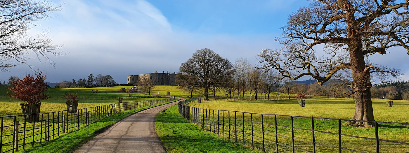
Chirk Castle
Chirk Castle was built around 1295 above the meeting point of the Rivers Dee and Ceiriog. With over 700 years of history, the medieval fortress is lavishly decorated and beautifully maintained.
The award-winning gardens cover 5.5 acres while the estate parkland covers over 480 acres. Located within an “Area of Outstanding Natural Beauty”, the site has also been designated a “Site of Special Scientific Interest” due to its inhabitation of rare species of wildlife. Effective planning for extreme weather is essential for efficient upkeep of the grounds, as well as preventative safety measures for all who visit.
“At Chirk Castle due to the large number of ancient and veteran trees on the estate we must plan for closure to the public in adverse weather conditions, in particular for high winds. Having a Skyview weather system installation on site allows us to access real-time, site-specific data. This is an invaluable aid in making decisions on the ground.
The easy access of historic wind speeds for the site, also allows us to make strategic, long-term decisions on wind closure thresholds, again based on real data. The web interface itself is instinctive and easy to use.
On the rare occasions we have had issues with the equipment the Skyview engineers have been prompt, helpful and efficient and have got us back up and running in good time.
I would recommend Skyview to anyone looking at a weather station solution.”
Keith Griffith, Area Ranger
National Trust - Chirk Castle
Erddig
Erddig Hall is a Grade-I listed building in Wrexham, sitting on the Welsh Clywedog River. The site itself is steeped in history and comprises a 1,900-acre estate, and a 1,200-acre landscaped park.
The storms of 2021 saw damage across this vast estate with many trees lost and the closures of several parts of the grounds.
Orford Ness NNR
Linked to the mainland in Aldeburgh, Orford Ness is an internationally important coastal nature reserve, with a fascinating 20th-century military history.
Visitors can access the remote shingle spit by the National Trust ferry Octavia, and follow trails through the stunning natural landscape.
A place of interest for ornithologists, serving as a “stop off” for many migrating birds from Scandinavia – the island is one of a limited number of locations in the UK where they can witness rare breeds during migration seasons.
As well as health and safety and operational reasons for weather monitoring, ecological studies are carried out on the island, often involving the ongoing monitoring of wind speed, wind direction, solar radiation and temperature. Monitoring and recording how rainfall levels, for example, affect the islands flower and fauna, and brackish water lagoons is of key interest to ecologists assessing the affects of precipitation and climate change.
“Orford Ness is an exposed shingle spit, only accessible by boat. We use our station on the Ness to remotely assess when we can cross to the property safely - and when we need to stick to the mainland. The local harbour master makes regular use of the web-based access too, which is something that we are happy to support. We also make use of the historical records in ongoing environmental monitoring projects and in forecasting our renewable energy needs.
We have had the station for over 5 years now. It is extremely reliable, Skyview have been very responsive to the few issues that we have had, and their engineers carry out planned servicing like clockwork.”
Dave Fincham, Facilities Manager – Suffolk & Essex Coast
National Trust - Sutton Hoo